
From Pixels to Proof: Why Sensor Fusion Is the Backbone of Credible Nature MRV
In our previous discussion on measurement and nature markets, we argued that credible data is the foundation on which these markets are built. If environmental outcomes are to be traded, financed, or reported against, they must be measurable in a way that is consistent, repeatable, and defensible. The challenge, however, is that nature is complex, dynamic, and spatially variable, particularly within working agricultural landscapes. Moving from the idea of measurement to the reality of it requires a step change in how data is collected, interpreted, and verified. This is where sensor fusion and modern MRV systems come into focus.
Historically, environmental measurement has relied heavily on field-based sampling. While scientifically rigorous, it is inherently limited: small numbers of survey plots are used to represent entire farms, and scaling those measurements introduces uncertainty and cost. At the same time, remote sensing has matured rapidly, offering the ability to observe land surfaces at high frequency and broad scale. Yet each sensing modality comes with its own blind spots. Optical imagery can struggle with cloud cover and mixed vegetation signals, radar provides robustness but less ecological nuance, and LiDAR delivers rich structural information but is typically intermittent and expensive. Individually, none of these sources provides a complete or sufficiently reliable picture for decision-making.
Sensor fusion addresses this limitation by combining multiple streams of data - optical, radar, LiDAR, and targeted field observations - into a single coherent system. The value lies not simply in adding more data, but in integrating complementary signals to produce insights that are greater than the sum of their parts. Structural information can anchor biomass estimates, spectral signals capture seasonal dynamics, and radar adds consistency in challenging weather conditions. When these inputs are harmonised and interpreted using advanced models, they enable more stable and representative estimates of vegetation extent, ecosystem condition, pasture production, and carbon stocks across diverse farm systems.
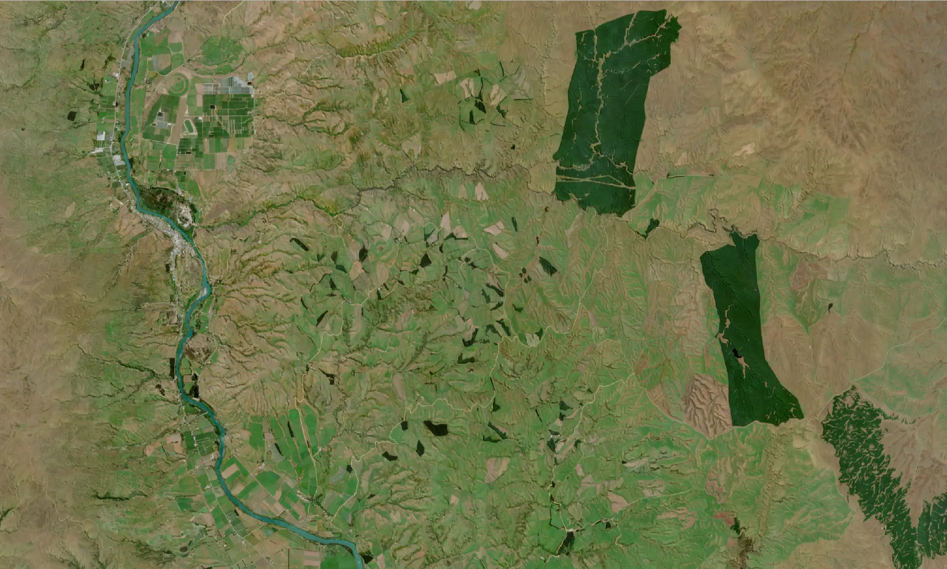
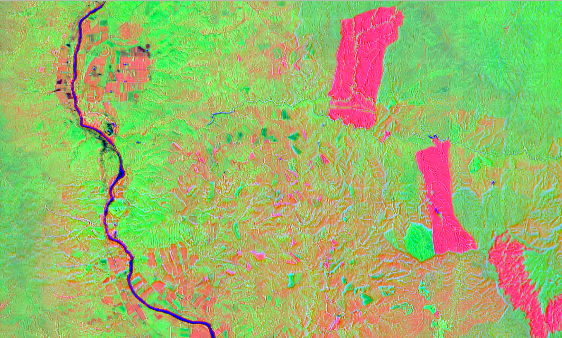
Comparison of a true-colour Sentinel-2 composite and learned embeddings for the Otago Highlands. The embeddings encode cross-sensor spectral and spatial relationships around each pixel, providing a general-purpose representation of remotely sensed data.
However, generating better measurements is only part of the problem. For nature markets to function, those measurements must also be trusted. This requires MRV systems that go beyond mapping outputs to provide traceability, transparency, and clear evidence chains. It is not enough to say what the state of nature is; systems must show how that conclusion was reached, quantify uncertainty, and maintain a record of the data and models used. In practical terms, this means building pipelines that ingest multi-sensor data, standardise it, apply validated models, and produce outputs that can withstand scrutiny from auditors, regulators, and buyers.
A key component of this approach is the role of field data. Rather than acting as the primary measurement tool, field observations become part of a calibration and validation framework, ensuring that models derived from remote sensing are grounded in reality. This allows measurement to scale without losing scientific integrity. It also enables continuous improvement, where each cycle of data collection and model testing tightens uncertainty and increases confidence in the outputs.
Another critical dimension is the treatment of uncertainty itself. Natural systems are inherently variable, and any measurement carries some degree of error. Modern MRV systems must therefore make uncertainty explicit - mapping confidence levels spatially and tracking how they change over time. This transforms uncertainty from a hidden weakness into a transparent and manageable aspect of the system, which is essential for building trust in both compliance and voluntary markets.
As standards evolve and expectations rise, the ability to attribute outcomes to specific on-farm actions is also becoming increasingly important. Whether it is riparian planting, shelterbelt establishment, or changes in grazing management, stakeholders want to understand not just what has changed, but why. For producers, exporters, and investors, these developments signal a shift away from fragmented and episodic measurement toward continuous, system-level monitoring of natural capital. The implication is that access to credible markets will increasingly depend on the quality of underlying MRV. Systems that can operate at scale, adapt to different geographies, and produce audit-ready outputs will define the leading edge.
Prism’s work sits directly in this space. By developing integrated MRV pipelines that fuse multi-sensor data with ecological models and machine learning, we are focused on turning complex environmental signals into traceable, decision-grade evidence. This includes building diverse training datasets, implementing versioned data architectures, and producing outputs with explicit uncertainty bounds and clear evidence chains. The goal is not just to measure nature, but to do so in a way that aligns with emerging international standards and supports real-world decision-making.
Ultimately, if the first phase of nature markets was about recognising the value of natural capital, the next phase is about proving it. Sensor fusion and robust MRV systems are what make that proof possible, transforming dispersed, noisy observations into credible evidence that can underpin markets, guide investment, and support better outcomes on the ground.