
El Niño Watch
This weather pattern is now strengthening. In partnership with MetService we offer a briefing service to help you understand and manage your location risk
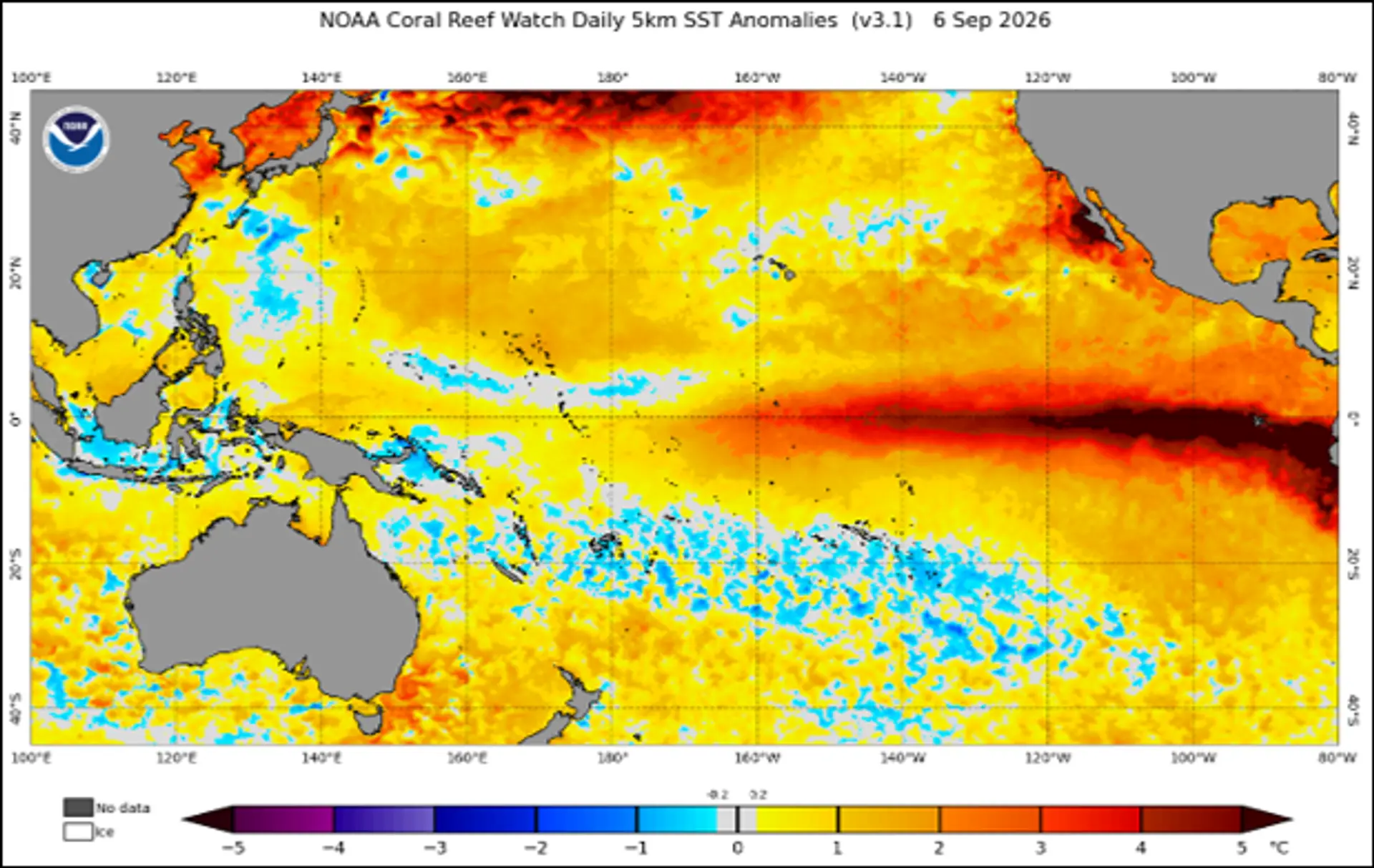
A classic, strong El Niño signature is evident in the Sea Surface Temperature (SST) anomalies in the Equatorial Pacific. This and other indicators point towards a record breaking, or near-record breaking event.
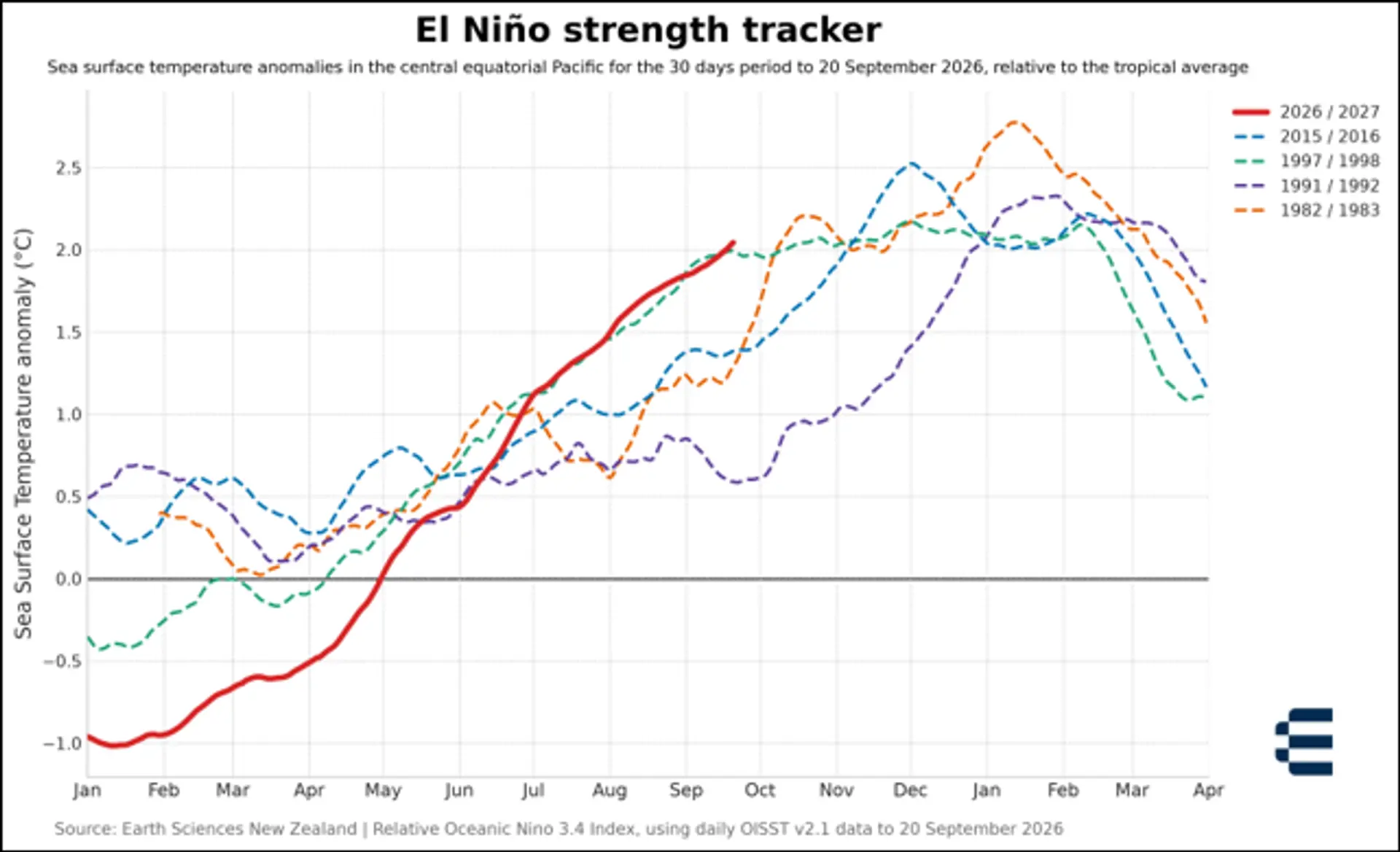
- El Niño should peak around November or December, remaining in place through the southern summer 2026/2027
- An easing back towards ENSO-neutral conditions is expected only from autumn 2027.
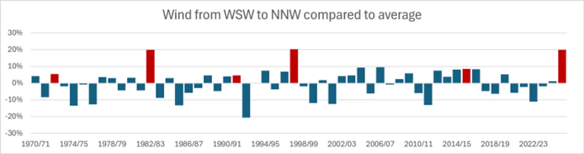
- El Niño typically promotes stronger and more frequent SW quarter winds and cooler springs.
We can help you understand the impacts on your business.
MetService forecasters use computer-driven climate predictions from the European Centre for Medium-Range Weather Forecasts (ECMWF) to estimate rainfall, temperature and humidity up to six months in advance.
These are then calculated as anomalies for key locations in your supply chain.
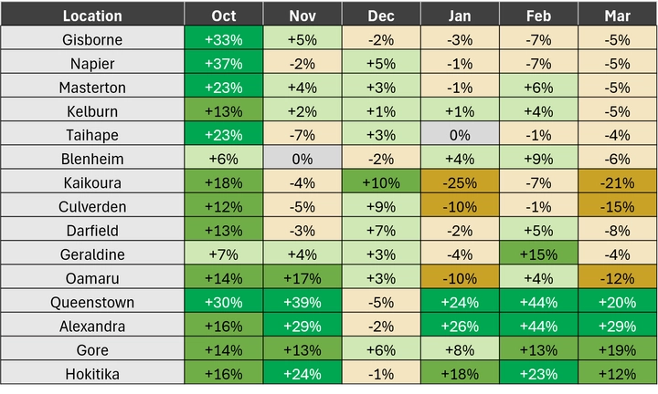
Note: values shown are illustrative only and represent differences against the long term climatic mean.

We use a scientifically modelled record of historical weather and environmental conditions (hindcast data) to analyse variables such as rainfall, temperature, soil moisture, wind, and solar radiation across past decades.
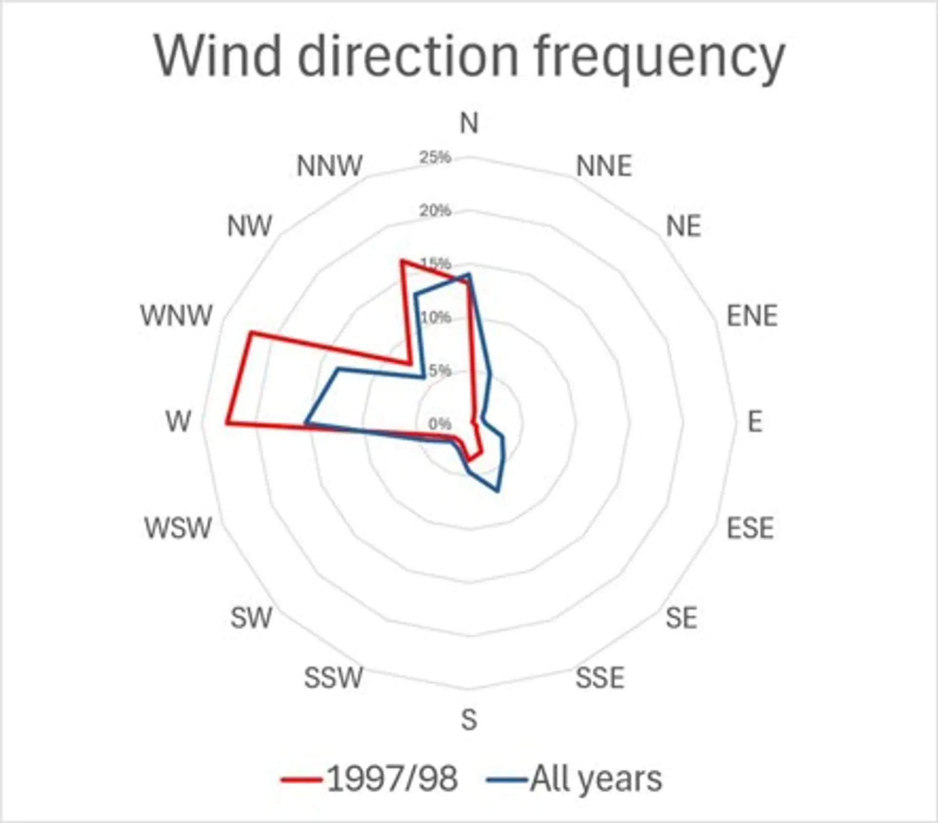
This enables us to generate insights such as this wind direction analysis which shows the predominance of westerlies during El Niño analogue years (in red).
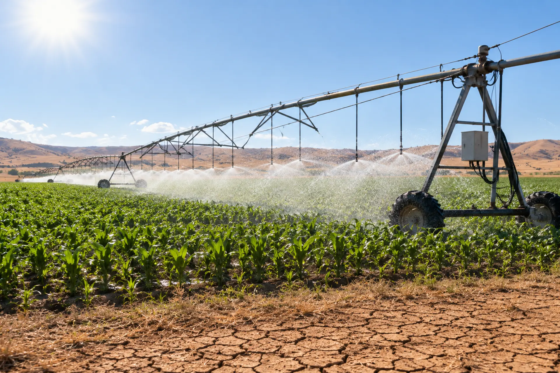
High Vapour Pressure (VPD) deficits can occur during warm, dry weather.
This increases the atmosphere's demand for water, causing plants to transpire more rapidly. For example, when VPD gets above about 1.5 kPa pasture loses water faster than roots can replace it.
Using hindcast and forecast data we project how many hours pasture and crops may be subjected to prolonged high VPD conditions leading to lower production.
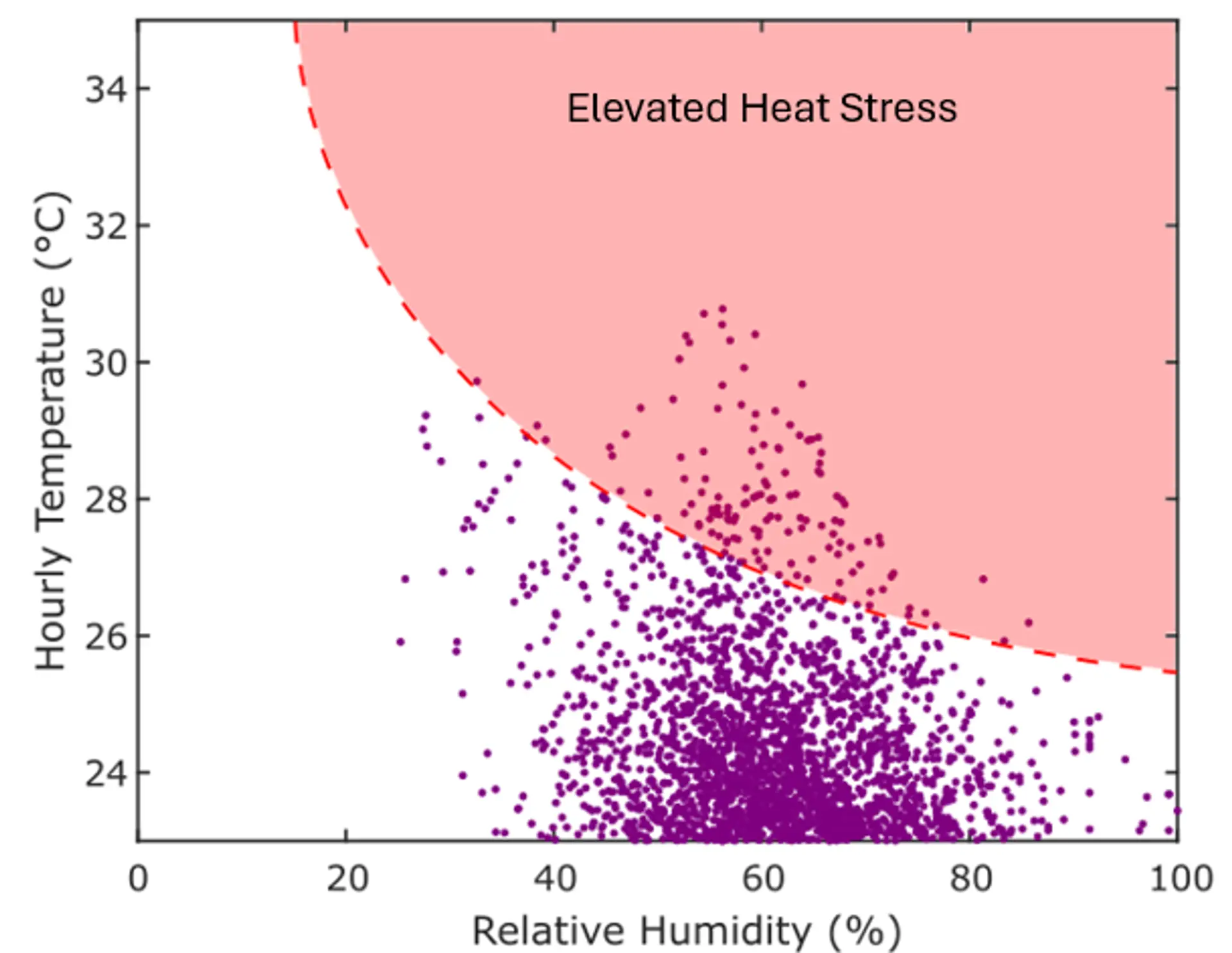
We also help you understand the potential impacts on heat stress using THI (Temperature Humidity Index) which is a measure that combines air temperature and relative humidity into a single value to estimate the level of heat stress experienced by livestock.
High humidity reduces an animal's ability to cool itself through evaporation, so THI is generally a better indicator of heat stress than temperature alone in cattle.
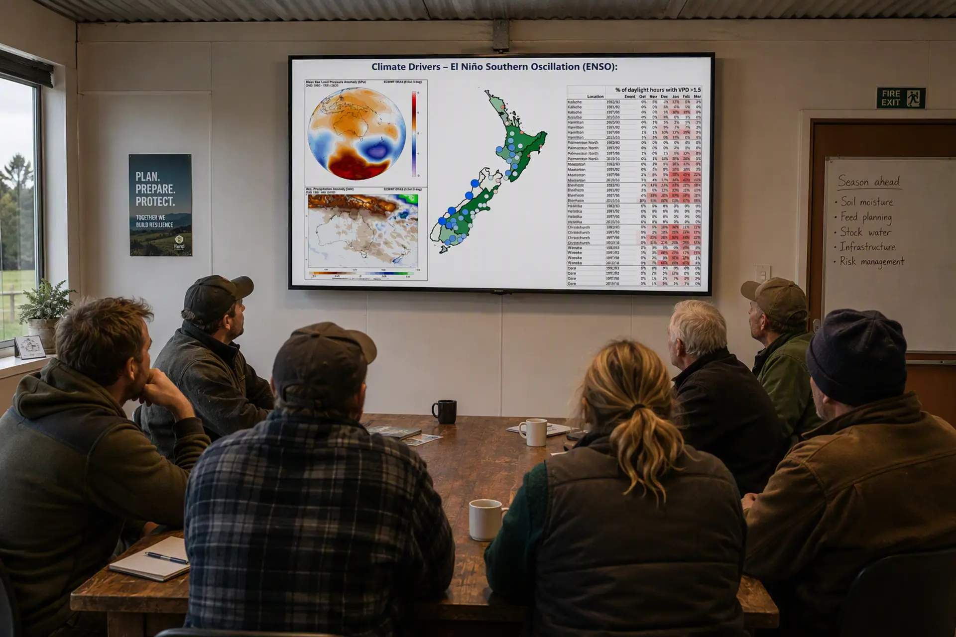
- Review of recent conditions
- Status of El Niño Southern Oscillation indicators.
- Climate Drivers and El Niño Analogues
- Pressure & Rainfall Anomaly Maps
- 6-month temperature and rainfall anomaly prediction
- Lessons from comparable historical El Niño events
- Potential impacts on rainfed pasture systems, livestock and agricultural operations
- Seasonal forecast discussion for all sub-regions
- Conclusions
El Niño Watch
Anticipate Risk. Act Early. Protect Production


MetService is New Zealand's official weather forecasting agency, with specialist expertise in predicting and communicating weather risks that affect agriculture, infrastructure, and public safety.
Using sophisticated landscape and climate insights Prism empowers land-based food producers to add value, safeguard productivity and meet science based targets with confidence.